
 AI generated
When the word nor’easter starts appearing in weather headlines, it can sound as though one enormous snowstorm is headed toward the entire East Coast.
That is not always what it means.
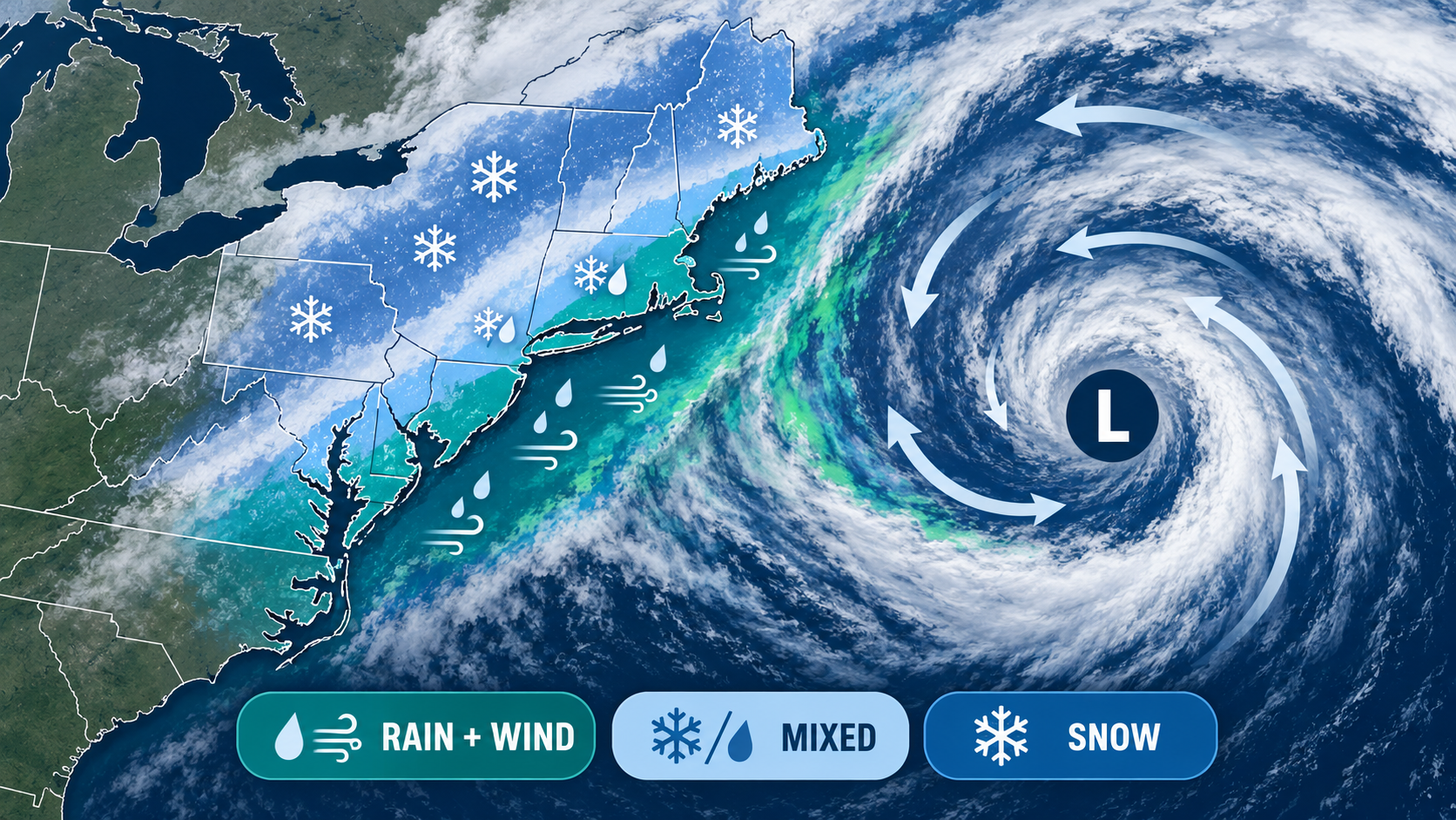
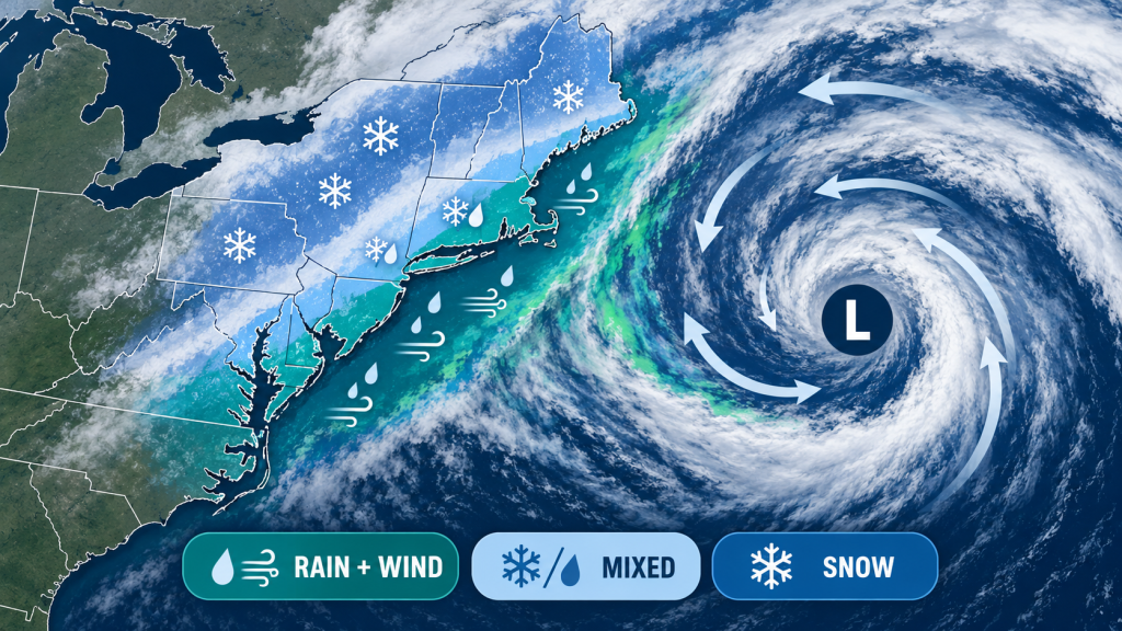
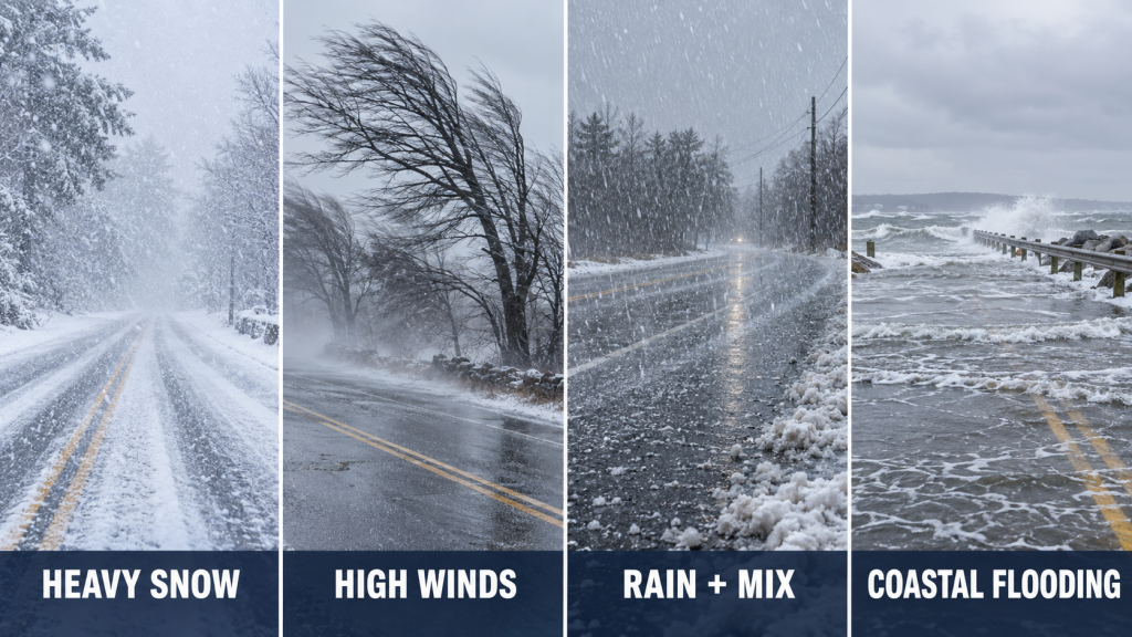
A nor’easter is a large storm system that typically affects the eastern United States and gets its name from the strong northeasterly winds that can develop along the coast. Depending on the storm’s track, temperatures, and timing, one area may get heavy snow while another sees mostly rain, damaging wind, rough surf, or coastal flooding.
So if you see “nor’easter” trending, the most useful question is not simply “Is a storm coming?”
It is:
Where is the storm tracking, what type of precipitation is expected in my area, how strong could the wind become, and what alerts have actually been issued?
A Nor’easter Is About the Storm Track, Not Just Snow
Nor’easters are commonly associated with major snowstorms, but snow is only one possible impact.
These storms form and strengthen along the East Coast, where differences in air temperature and moisture can support the development of a powerful low-pressure system.
The Atlantic Ocean can provide abundant moisture, while colder air positioned inland may allow snow or a wintry mix to develop.
But even a relatively small change in the storm track can dramatically change what happens at one particular address.
If the low tracks farther offshore, inland locations may receive less precipitation while coastal areas experience stronger winds and rougher surf.
If the storm tracks closer to the coast, warmer marine air may push farther inland. That can turn expected snow into sleet, freezing rain, or plain rain for some communities.
Farther inland, the same storm may still produce significant snowfall.
Do not judge a nor’easter only by a dramatic regional snowfall map. Look at the forecast for your specific location and pay attention to how the predicted storm track changes over time.
Start With Official Alerts Before Looking at Snowfall Totals
When weather coverage becomes intense, people often jump straight to snowfall totals.
That can cause unnecessary confusion because a forecast amount is not the same thing as an official warning.
A better first step is to check the alerts issued for your location by the National Weather Service.
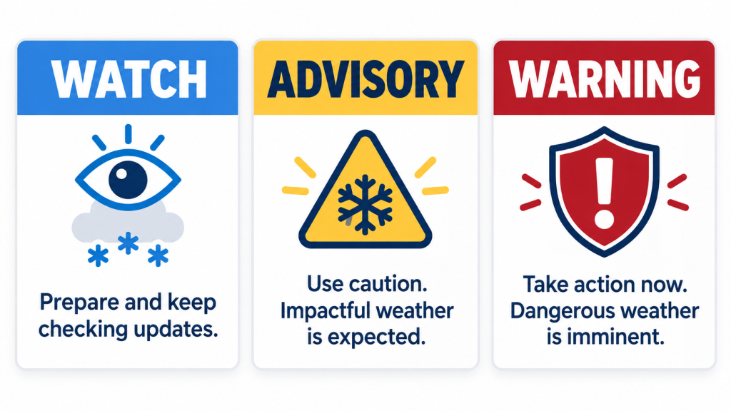
Weather alerts use specific terms that tell you something about both the confidence and the potential seriousness of the event.
Watch
A watch generally means hazardous weather is possible and conditions are favorable enough that people should begin paying closer attention.
It is the stage when checking travel plans, charging devices, and making sure basic supplies are available makes sense.
Warning
A warning indicates that hazardous weather is occurring, imminent, or expected with enough confidence that people should take action.
The exact action depends on the warning.
A Winter Storm Warning, High Wind Warning, Coastal Flood Warning, and Blizzard Warning describe different hazards.
Advisory
An advisory generally describes weather that may not reach warning criteria but can still create dangerous or disruptive conditions.
For example, a relatively modest amount of freezing precipitation can create serious driving problems even if the storm never becomes a headline-making blizzard.
For current U.S. alerts, the National Weather Service is the most important place to verify what has actually been issued for your location:
weather.gov.
Do Not Read a Snow Map Without Checking the Time Period
One of the easiest ways to misunderstand a winter storm forecast is to see a number such as “8 inches” without checking what the map actually represents.
Is that expected snowfall through Tuesday morning?
Is it the entire storm total?
Is it a probability map showing the chance of exceeding a certain amount?
Is it one model run rather than an official forecast?
Those are completely different products.
Before sharing a snowfall graphic, check four things:
- Who created the map?
- What geographic area does it cover?
- What start and end time does it use?
- Is it an official forecast, a model, or a probability product?
A screenshot circulating on social media without those details can quickly become misleading.
Wind Can Become a Bigger Problem Than the Snow
A nor’easter does not need to produce record snowfall to cause major disruption.
Strong winds can bring down tree limbs, damage power lines, make high-profile vehicles difficult to control, and create dangerous conditions along the coast.
The combination of wet snow and wind deserves particular attention.
Heavy, moisture-rich snow can accumulate on branches and utility lines. Add strong wind, and the risk of falling limbs and power interruptions can increase.
If your area is expecting strong wind, look beyond the peak wind speed.
Check:
- expected wind gusts,
- the hours when winds may be strongest,
- whether a High Wind Watch or Warning is in effect,
- and whether local utilities are warning about possible outages.
For a family at home, this information can be more useful than knowing the exact snow total.
Coastal Flooding Is a Separate Hazard
People living well inland may think of a nor’easter primarily as a winter precipitation event.
Along the coast, the story can be very different.
Persistent onshore winds can push water toward the coastline, especially when storm conditions line up with high tide.
That can lead to flooding of low-lying roads, beach erosion, dangerous surf, and problems in communities that may receive little or no snow.
If you live near the coast, do not assume a snowfall forecast tells you whether the storm is dangerous.
Look specifically for:
Coastal Flood Advisories, Coastal Flood Warnings, High Surf Advisories, and local tide information.
 AI generated
Rain, Snow, Sleet or Freezing Rain? Temperature Is Only Part of It
When a nor’easter approaches, one of the hardest forecast questions is often where the rain-snow line will set up.
Surface temperature matters, but it is not the only factor.
Meteorologists also examine the temperature of the atmosphere above the surface.
A shallow layer of cold air near the ground with warmer air above it can produce very different precipitation from a column of air that remains below freezing.
That is why two towns only a short distance apart can experience dramatically different conditions.
One may receive heavy snow while another sees sleet or cold rain.
For drivers, freezing rain can be especially important because even a small amount of ice can make untreated roads and sidewalks extremely slippery.
Expect the forecast to change more than it would for a location comfortably within the cold or warm side of the storm.
How to Check Whether Travel Will Actually Be Difficult
A forecast saying “snow is expected” does not automatically tell you whether driving will be difficult at 8 a.m.
Timing matters.
A storm arriving after the evening commute creates a very different travel problem from one that begins two hours before the morning rush.
Before deciding whether a trip is reasonable, check:
- when precipitation is expected to begin,
- when the heaviest precipitation is expected,
- whether temperatures may fall below freezing,
- when winds are expected to peak,
- and when conditions are expected to improve.
Then look at state and local transportation information rather than relying only on a national weather map.
Road conditions can vary widely because treatment, elevation, traffic, and local temperatures all matter.
Air Travel Can Be Affected Far Outside the Snow Zone
Large East Coast storms can disrupt flights even for travelers whose local weather looks perfectly fine.
A plane arriving from or connecting through an affected airport may be delayed before it ever reaches you.
If you have a flight during a nor’easter, check the airline directly rather than relying only on the departure board at the airport.
Also look at conditions at your connecting airport and the airport where your aircraft is originating.
That provides a much better picture of potential disruption.
A Practical Power-Outage Check Before the Storm
If strong winds or heavy wet snow are possible, preparing for a short power outage does not require turning the house into an emergency bunker.
Start with the things that become immediately inconvenient when electricity disappears.
Charge phones and portable battery packs.
Know where flashlights are.
Make sure essential medications and necessary supplies are available.
If your home depends on electrically powered medical equipment or another critical device, your preparation needs may be more specific and should be planned well before severe weather arrives.
Ready.gov provides general U.S. emergency-preparedness information at
ready.gov.
Another useful step is saving your electric utility’s outage-reporting page or phone number before the storm begins.
Trying to find that information for the first time during an outage is unnecessarily frustrating.
What About The Weather Channel and Other Weather Apps?
The Weather Channel, television meteorologists, and weather apps can be very useful for understanding the overall storm story and seeing forecast trends.
They are especially helpful when trying to visualize the storm track and understand when conditions may change.
But for official watches, warnings, and location-specific hazard information in the United States, it is worth checking the National Weather Service as well.
Using both types of information works better than treating one dramatic weather graphic as the entire forecast.
Why the Forecast May Change Even a Day Before the Storm
A changing forecast does not necessarily mean the meteorologists were careless.
The atmosphere is a complex system, and a difference of tens of miles in the track of a coastal low can shift the heaviest snow band, rain-snow line, or strongest winds.
As the storm gets closer, weather balloons, aircraft observations, radar, satellites, and surface observations provide additional information that can improve the forecast.
That is why a snowfall map issued three days before a storm should not be treated as a guaranteed final total.
The closer you get to the event, the more useful it becomes to focus on the range of possible outcomes and the official warnings rather than a single exact number.
The Four Things Worth Checking Before Bed
If a nor’easter is expected overnight, you do not need to spend the entire evening refreshing weather apps.
Before going to bed, check four things:
1. Your current NWS alerts.
2. The expected start time of the worst conditions.
3. Whether wind or ice could threaten power or travel.
4. Whether schools, transportation agencies, airlines, or local authorities have issued changes that affect your morning.
Then check again in the morning because overnight changes in the storm track can alter the local forecast.
Do Not Let the Word “Nor’easter” Tell You the Whole Story
Two nor’easters can produce completely different experiences.
One may become a major inland snowstorm.
Another may be remembered primarily for coastal flooding and wind.
A third may produce heavy rain in large cities while snow falls farther inland.
That is why the name of the storm is less important than the hazards expected at your location.
Instead of asking only “How big is the nor’easter?”, ask:
“What is expected where I live, when will the worst conditions arrive, and which hazard is most likely to affect me?”
Those questions turn a dramatic weather headline into information you can actually use.
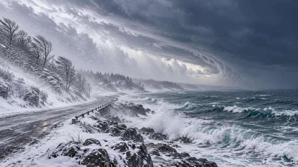 AI generated
Leave a Reply